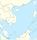
Soubor:South China Sea location map.svg

Velikost tohoto PNG náhledu tohoto SVG souboru: 553 × 599 pixelů. Jiná rozlišení: 221 × 240 pixelů | 443 × 480 pixelů | 709 × 768 pixelů | 945 × 1 024 pixelů | 1 890 × 2 048 pixelů | 1 134 × 1 229 pixelů.
Původní soubor (soubor SVG, nominální rozměr: 1 134 × 1 229 pixelů, velikost souboru: 617 KB)
Historie souboru
Kliknutím na datum a čas se zobrazí tehdejší verze souboru.
| Datum a čas | Náhled | Rozměry | Uživatel | Komentář | |
|---|---|---|---|---|---|
| současná | 17. 8. 2011, 20:56 |  | 1 134 × 1 229 (617 KB) | NordNordWest | == {{int:filedesc}} == {{Information |Description= {{de|Positionskarte des Südchinesischen Meers}} Quadratische Plattkarte, N-S-Streckung 102 %. Geographische Begrenzung der Karte: * N: 25.5° N * S: 0° N * W: 98.5° O * O: |
Využití souboru
Tento soubor používají následující 2 stránky:
Globální využití souboru
Tento soubor využívají následující wiki:
- Využití na an.wikipedia.org
- Využití na ar.wikipedia.org
- Využití na az.wikipedia.org
- Využití na ban.wikipedia.org
- Využití na bcl.wikipedia.org
- Využití na be.wikipedia.org
- Využití na bn.wikipedia.org
- Využití na ceb.wikipedia.org
- Využití na de.wikipedia.org
- Využití na en.wikipedia.org
- Kaohsiung
- Paracel Islands
- Spratly Islands
- Hainan
- Weizhou Island
- Pratas Island
- Natuna Regency
- Woody Island (South China Sea)
- Batam
- Third Taiwan Strait Crisis
- Anambas Islands Regency
- Taiping Island
- Scarborough Shoal
- Kalayaan, Palawan
- Trường Sa (township)
- Thitu Island
- List of temples of the Church of Jesus Christ of Latter-day Saints by geographic region
- List of airports in Taiwan
- Tree Island, South China Sea
- Rocky Island, South China Sea
- Triton Island
- Bombay Reef
- Natuna Besar
- Sansha
- 1967 USS Forrestal fire
- Spratly Island
- Mischief Reef
- Ko Losin
- Weizhou, Guangxi
- Ranai-Natuna Airport
- Matak Airport
- Kien An Airport
Zobrazit další globální využití tohoto souboru.


