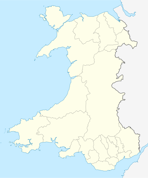
Soubor:Wales location map.svg

Velikost tohoto PNG náhledu tohoto SVG souboru: 501 × 599 pixelů. Jiná rozlišení: 201 × 240 pixelů | 401 × 480 pixelů | 642 × 768 pixelů | 856 × 1 024 pixelů | 1 713 × 2 048 pixelů | 1 047 × 1 252 pixelů.
Původní soubor (soubor SVG, nominální rozměr: 1 047 × 1 252 pixelů, velikost souboru: 237 KB)
Historie souboru
Kliknutím na datum a čas se zobrazí tehdejší verze souboru.
| Datum a čas | Náhled | Rozměry | Uživatel | Komentář | |
|---|---|---|---|---|---|
| současná | 24. 6. 2009, 14:27 |  | 1 047 × 1 252 (237 KB) | NordNordWest | {{Information |Description= {{de|Positionskarte von Wales, Vereinigtes Königreich}} Quadratische Plattkarte, N-S-Streckung 163 %. Geographische Begrenzung der Karte: * N: 53.5° N * S: 51.3° N * W: 5.5° W * |
Využití souboru
Tento soubor používá následujících 58 stránek:
- Aberaeron
- Aberdare
- Aberfan
- Abergavenny
- Abergwyngregyn
- Amlwch
- Ammanford
- Bangor (Wales)
- Beaumaris
- Blaenau Ffestiniog
- Brecon
- Breconská katedrála
- Bridgend
- Caerleon
- Caernarfon
- Caerphilly
- Cardiff
- Carmarthen
- Chepstow
- Colwyn Bay
- Conwy
- Cwmgiedd
- Dinas Powys
- Dixton
- Garnant
- Holyhead
- Klášter Aberconwy
- Lampeter
- Llanberis
- Llanelli
- Llanfair (Gwynedd)
- Llanfair Caereinion
- Llanfairpwllgwyngyllgogerychwyrndrobwllllantysiliogogogoch
- Llantwit Major
- Machynlleth
- Magor (Monmouthshire)
- Merthyr Tydfil
- Milford Haven
- Monmouth
- New Quay
- Newcastle Emlyn
- Newport
- Pembroke (Pembrokeshire)
- Penarth
- Pontypool
- Pontypridd
- Prestatyn
- Rhosllannerchrugog
- Ruthin
- St Asaph
- St Davids
- St Fagans
- Swansea
- Welshpool
- Wrexham
- Ystrad Mynach
- Ystradgynlais
- Šablona:LocMap Wales
Globální využití souboru
Tento soubor využívají následující wiki:
- Využití na af.wikipedia.org
- Využití na ar.wikipedia.org
- Využití na ast.wikipedia.org
- Využití na az.wikipedia.org
- Využití na ba.wikipedia.org
- Využití na bg.wikipedia.org
- Využití na bh.wikipedia.org
- Využití na bn.wikipedia.org
- Využití na br.wikipedia.org
- Dolgellau
- Bangor-is-y-coed
- Aberaeron
- Patrom:Infobox UK place
- Rhaeadr Gwy
- Llanfachraeth (Mon)
- Trefor (Mon)
- Caergybi
- Aberporth
- Beulah (Ceredigion)
- Llanfihangel-yn-Nhywyn
- Abermaw
- Llan-faes (Mon)
- Ynyslas
- Clynnog Fawr
- Ffair-rhos
- Patrom:Location map Kembre
- Bont Goch
- Gilfachreda
- Parc-llyn
- Pennant (Ceredigion)
- Brongest
- Bryngwyn (Ceredigion)
- Brynafan
- Brynhoffnant
- Coed-y-bryn
- Cwmsychbant
Zobrazit další globální využití tohoto souboru.
