Soubor:South Orkney Islands-en.svg

Velikost tohoto PNG náhledu tohoto SVG souboru: 800 × 476 pixelů. Jiná rozlišení: 320 × 190 pixelů | 640 × 381 pixelů | 1 024 × 609 pixelů | 1 280 × 761 pixelů | 2 560 × 1 523 pixelů | 2 303 × 1 370 pixelů.
Původní soubor (soubor SVG, nominální rozměr: 2 303 × 1 370 pixelů, velikost souboru: 252 KB)
| Tento soubor pochází z Wikimedia Commons. Níže jsou zobrazeny informace, které obsahuje jeho tamější stránka s popisem souboru. |
Popis
| Popis |
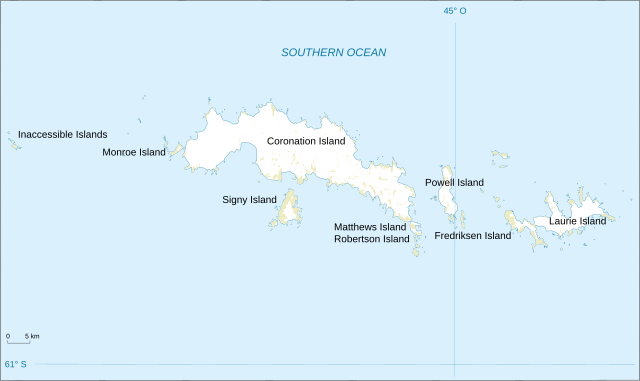
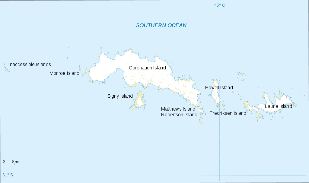
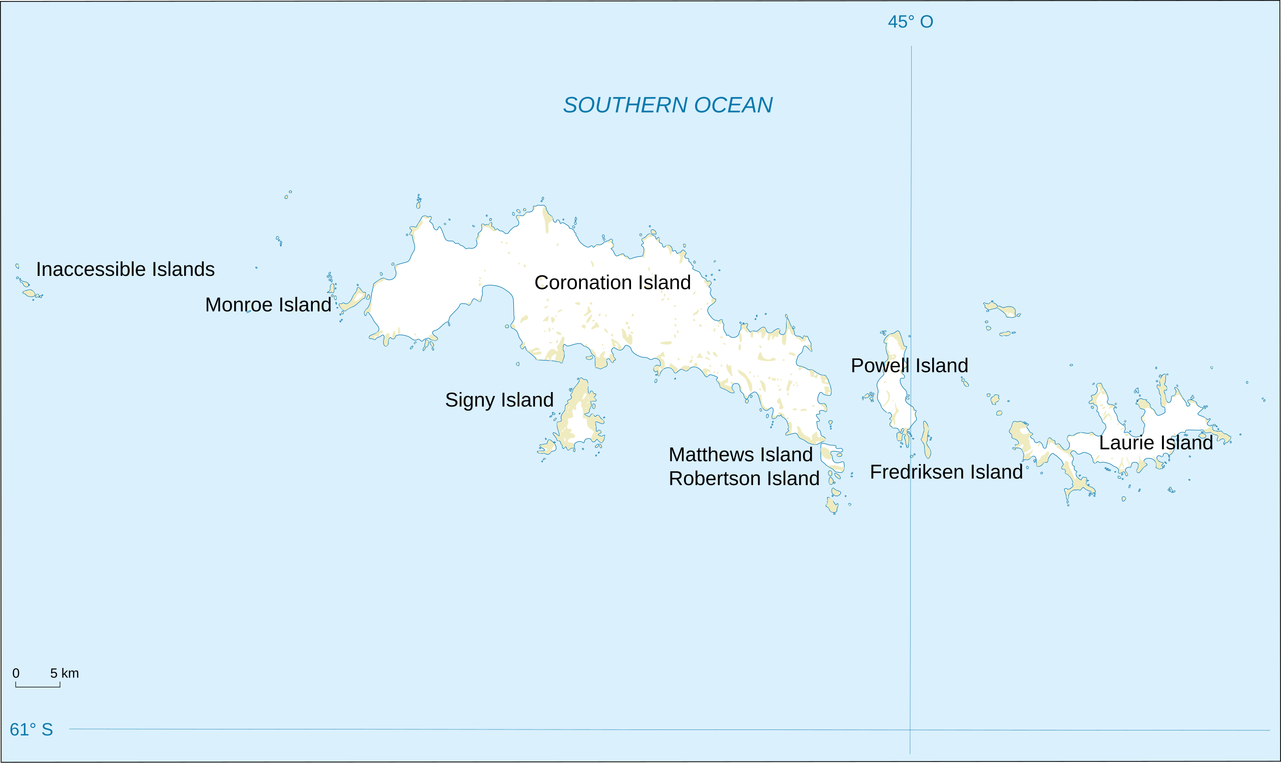
English: Map of South Orkney Islands.
Français : Carte des Iles Orcades du Sud.
Italiano: Mappa delle Isole Orcadi Meridionali. |
| Datum | |
| Zdroj | Landsat Image Mosaic Of Antarctica (LIMA) |
| Autor | Shakki |
| Další verze |
|


Licence
Tento soubor je volné dílo, protože obsahuje materiály pocházející od United States Geological Survey (USGS), agentury Ministerstva vnitra USA. Pro bližší informaci vizte oficiální licenční pravidla USGS (anglicky).
|
Historie souboru
Kliknutím na datum a čas se zobrazí tehdejší verze souboru.
| Datum a čas | Náhled | Rozměry | Uživatel | Komentář | |
|---|---|---|---|---|---|
| současná | 17. 3. 2008, 20:32 | | 2 303 × 1 370 (252 KB) | Shakki | {{Information |Description={{en|Map of South Orkney Islands}} {{fr|Carte des Iles Orcades du Sud}} |Source=[http://gisdata.usgs.gov/website/antarctic_research_atlas/ Landsat Image Mosaic Of Antarctica (LIMA)] |Date=Mar 2008 |Author=Shakki |
Využití souboru
Tento soubor používá následující stránka:
Globální využití souboru
Tento soubor využívají následující wiki:
- Využití na af.wikipedia.org
- Využití na ang.wikipedia.org
- Využití na ar.wikipedia.org
- Využití na ast.wikipedia.org
- Využití na az.wikipedia.org
- Využití na be.wikipedia.org
- Využití na br.wikipedia.org
- Využití na bs.wikipedia.org
- Využití na ca.wikipedia.org
- Využití na ceb.wikipedia.org
- Využití na da.wikipedia.org
- Využití na de.wikipedia.org
- Využití na el.wikipedia.org
- Využití na en.wikipedia.org
- South Orkney Islands
- Scottish National Antarctic Expedition
- Laws Glacier
- Buchanan Point
- Orwell Glacier
- Jane Peak
- Sunshine Glacier
- Cape Murdoch
- Cape Mabel
- McLeod Glacier (South Orkney Islands)
- Thomson Point
- Cape Valavielle
- Cape Robertson
- Roald Glacier
- Tioga Lake (South Orkney Islands)
- Three Lakes Valley (South Orkney Islands)
- Module:Location map/data/South Orkney Islands
- Module:Location map/data/South Orkney Islands/doc
- Využití na es.wikipedia.org
- Využití na fa.wikipedia.org
Zobrazit další globální využití tohoto souboru.