Soubor:Scandinavia1219.png
Velikost tohoto náhledu: 513 × 600 pixelů. Jiná rozlišení: 205 × 240 pixelů | 410 × 480 pixelů | 657 × 768 pixelů | 876 × 1 024 pixelů | 1 500 × 1 754 pixelů.
Původní soubor (1 500 × 1 754 pixelů, velikost souboru: 41 KB, MIME typ: image/png)
| Tento soubor pochází z Wikimedia Commons. Níže jsou zobrazeny informace, které obsahuje jeho tamější stránka s popisem souboru. |
| Popis |
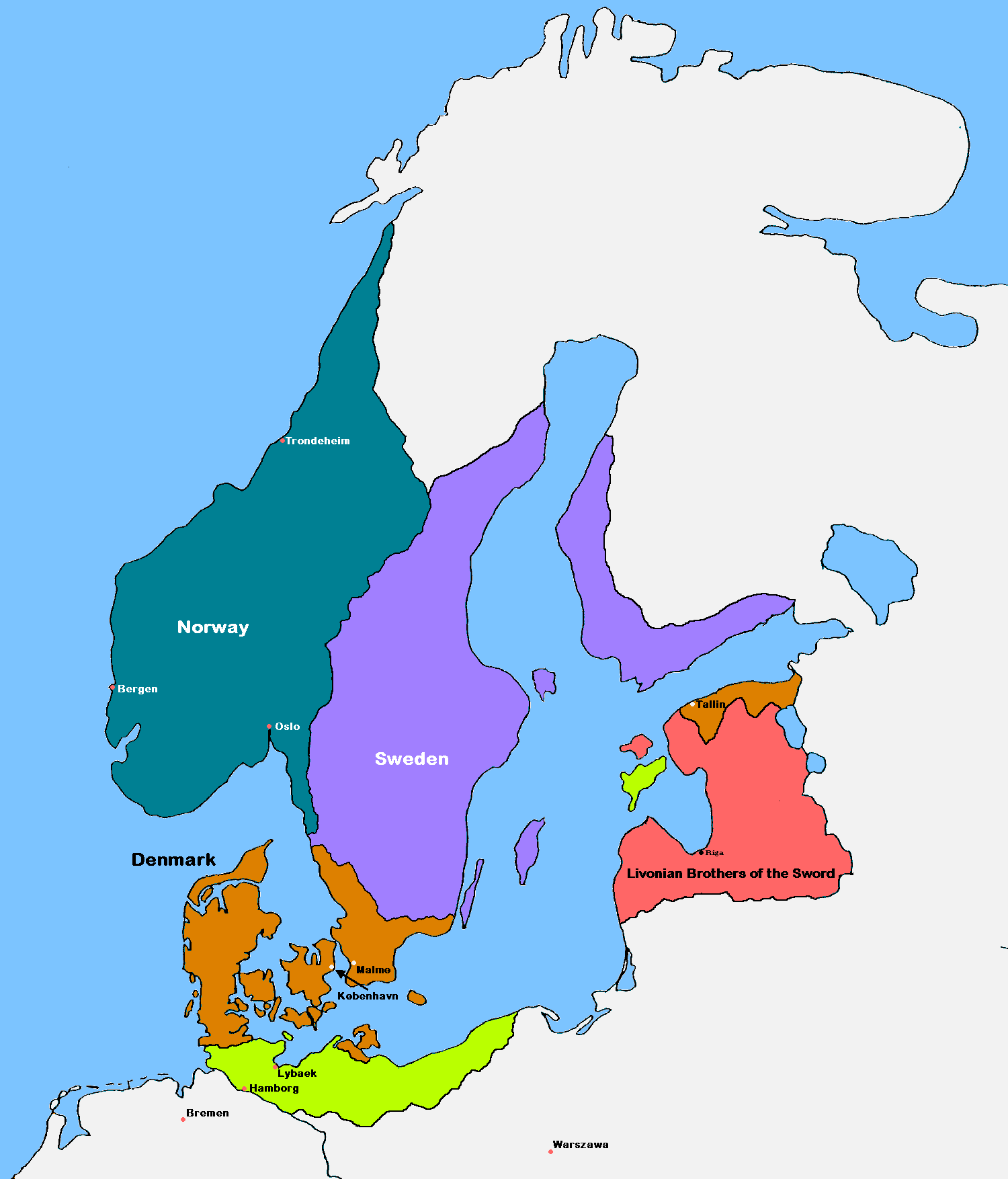
English: Update of the historical and political map, created in 2005 by Kasper Holl. It is a compressed format, has an easier colour scheme and has greater sized labels. NB on accuracy: Sweden did not reach this size until after the 1330s, when colonialization of Västerbotten started. Swedish colonialization of Finnish coast started before 1250. Sweden lost Gotland to Denmark in 1361. Trondheim has a wrong placement on map.
Denmark
Norway
Sweden
The Sword Brethren
Territories conquered by Denmark in 1219 |
| Datum | (UTC) |
| Zdroj |
|
| Autor | MasterOfHisOwnDomain |
| Další verze |
|

Já, držitel autorských práv k tomuto dílu, ho tímto zveřejňuji za podmínek následujících licencí:

|
Tento dokument smí být kopírován, šířen nebo upravován podle podmínek Svobodné licence GNU pro dokumenty verze 1.2 nebo libovolné vyšší verze publikované nadací Free Software Foundation. Dokument nemá neměnné části ani texty na předním či zadním přebalu. Kopie textu licence je k dispozici v oddíle nazvaném GNU Free Documentation License. |
| Tento soubor podléhá licenci Creative Commons Uveďte autora-Zachovejte licenci 3.0 Unported | ||
| ||
| Tato licenční šablona byla k tomuto souboru přidána v rámci změny licencování. |
Můžete si zvolit libovolnou z těchto licencí.
Historie souboru
Kliknutím na datum a čas se zobrazí tehdejší verze souboru.
| Datum a čas | Náhled | Rozměry | Uživatel | Komentář | |
|---|---|---|---|---|---|
| současná | 16. 9. 2016, 19:18 | | 1 500 × 1 754 (41 KB) | VulpesVulpes42 | According to the description, the cities of Stockholm and Göteborg did not exist in 1219, so I removed them from the map. |
| 12. 8. 2009, 16:37 |  | 1 500 × 1 754 (68 KB) | MasterOfHisOwnDomain | Update of the historical and political map, created in 2005 by Kasper Holl. It is a compressed format, has an easier colour scheme and has greater sized labels. {{Self|GFDL|Cc-by-sa-3.0-migrated}} Category:Maps of the history of Denmark [[Category: |
Využití souboru
Tento soubor používají následující 2 stránky:
Globální využití souboru
Tento soubor využívají následující wiki:
- Využití na ast.wikipedia.org
- Využití na be.wikipedia.org
- Využití na ca.wikipedia.org
- Využití na da.wikipedia.org
- Využití na de.wikipedia.org
- Využití na dsb.wikipedia.org
- Využití na el.wikipedia.org
- Využití na en.wikipedia.org
- Northern Crusades
- History of Denmark
- Valdemar II of Denmark
- Duchy of Pomerania
- Otto I, Duke of Brunswick-Lüneburg
- Battle of Bornhöved (1227)
- Christianization of Pomerania
- Dominium maris baltici
- Template:Scandinavia map, 1219
- Denmark–Sweden border
- Borders of Denmark
- User:Falcaorib/Baltic States
- User:Falcaorib/Sweden and Finland
- Využití na eo.wikipedia.org
- Využití na es.wikipedia.org
- Využití na et.wikipedia.org
- Využití na fr.wikipedia.org
- Využití na fy.wikipedia.org
- Využití na id.wikipedia.org
- Využití na is.wikipedia.org
Zobrazit další globální využití tohoto souboru.