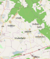
Soubor:Radim Map.png

Velikost tohoto náhledu: 504 × 599 pixelů. Jiná rozlišení: 202 × 240 pixelů | 536 × 637 pixelů.
Původní soubor (536 × 637 pixelů, velikost souboru: 290 KB, MIME typ: image/png)
Historie souboru
Kliknutím na datum a čas se zobrazí tehdejší verze souboru.
| Datum a čas | Náhled | Rozměry | Uživatel | Komentář | |
|---|---|---|---|---|---|
| současná | 9. 10. 2012, 18:23 |  | 536 × 637 (290 KB) | Janet11 | Largest descriptions |
| 8. 10. 2012, 19:49 |  | 400 × 476 (181 KB) | Janet11 | new description of parts | |
| 8. 10. 2012, 18:40 |  | 400 × 476 (181 KB) | Janet11 | the other coordinates | |
| 2. 10. 2012, 20:37 |  | 408 × 599 (250 KB) | Janet11 | Descriptions of parts of Radim | |
| 2. 10. 2012, 12:43 |  | 536 × 787 (256 KB) | Janet11 | {{Information |Description ={{en|1=Map of Radim (Jicin district)}} {{cs|1=Katastrální mapa obce Radimi (okres Jičín)}} |Source =OpenStreetMap |Author =Janet11 |Date =2012-10-01 |Permission = |other_versions = }} |
Využití souboru
Tento soubor používá následující stránka:
