Soubor:Northamptonshire UK locator map 2010.svg

Velikost tohoto PNG náhledu tohoto SVG souboru: 494 × 600 pixelů. Jiná rozlišení: 198 × 240 pixelů | 395 × 480 pixelů | 633 × 768 pixelů | 843 × 1 024 pixelů | 1 687 × 2 048 pixelů | 1 108 × 1 345 pixelů.
Původní soubor (soubor SVG, nominální rozměr: 1 108 × 1 345 pixelů, velikost souboru: 302 KB)
| Tento soubor pochází z Wikimedia Commons. Níže jsou zobrazeny informace, které obsahuje jeho tamější stránka s popisem souboru. |
Popis
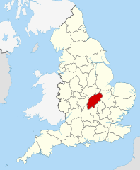
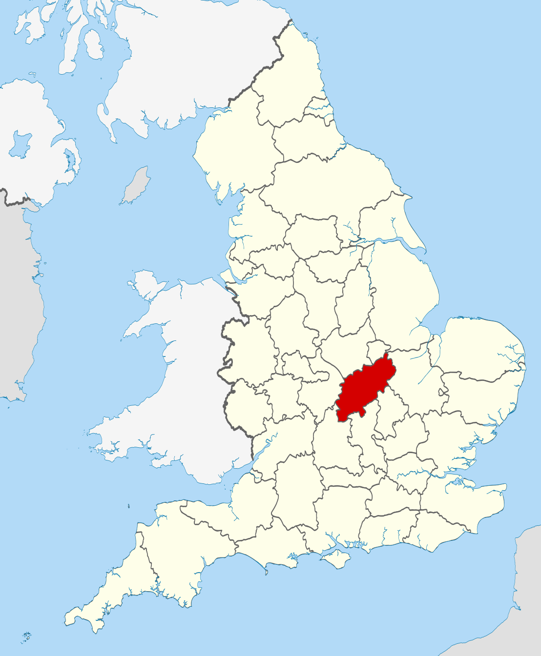
| Popis | Location of the ceremonial county of Northamptonshire within England. |
| Datum | |
| Zdroj |
National Geospatial-Intelligence Agency
|
| Autor | Nilfanion |
Licence
Já, držitel autorských práv k tomuto dílu, ho tímto zveřejňuji za podmínek následujících licencí:
Tento soubor podléhá licenci Creative Commons Uveďte autora-Zachovejte licenci 3.0 Unported
- Dílo smíte:
- šířit – kopírovat, distribuovat a sdělovat veřejnosti
- upravovat – pozměňovat, doplňovat, využívat celé nebo částečně v jiných dílech
- Za těchto podmínek:
- uveďte autora – Máte povinnost uvést autorství, poskytnout odkaz na licenci a uvést, pokud jste provedli změny. Toho můžete docílit jakýmkoli rozumným způsobem, avšak ne způsobem naznačujícím, že by poskytovatel licence schvaloval nebo podporoval vás nebo vaše užití díla.
- zachovejte licenci – Pokud tento materiál jakkoliv upravíte, přepracujete nebo použijete ve svém díle, musíte své příspěvky šířit pod stejnou nebo slučitelnou licencí jako originál.

|
Tento dokument smí být kopírován, šířen nebo upravován podle podmínek Svobodné licence GNU pro dokumenty verze 1.2 nebo libovolné vyšší verze publikované nadací Free Software Foundation. Dokument nemá neměnné části ani texty na předním či zadním přebalu. Kopie textu licence je k dispozici v oddíle nazvaném GNU Free Documentation License. |
Můžete si zvolit libovolnou z těchto licencí.

|
This is one of the images forming part of the Valued image set: Locator maps of the Ceremonial counties of England on Wikimedia Commons. The image set has been assessed under the valued image set criteria and is considered the most valued set on Commons within the scope:
Locator maps of the Ceremonial counties of England
You can see its nomination at Commons:Valued image candidates/Locator maps of English ceremonial counties. |
Historie souboru
Kliknutím na datum a čas se zobrazí tehdejší verze souboru.
| Datum a čas | Náhled | Rozměry | Uživatel | Komentář | |
|---|---|---|---|---|---|
| současná | 24. 11. 2010, 00:41 | | 1 108 × 1 345 (302 KB) | Nilfanion | == Summary == {{Information |Description=Location of the ceremonial county of Northamptonshire within England. |Source=Ordnance Survey [https://www.ordnancesurvey.co.uk/opendatadownload/products.html OpenData]: |
Využití souboru
Tento soubor používá následující stránka:
Globální využití souboru
Tento soubor využívají následující wiki:
- Využití na af.wikipedia.org
- Využití na ar.wikipedia.org
- Využití na arz.wikipedia.org
- Využití na ast.wikipedia.org
- Využití na be-tarask.wikipedia.org
- Využití na bg.wikipedia.org
- Využití na ca.wikipedia.org
- Využití na ceb.wikipedia.org
- Využití na dag.wikipedia.org
- Využití na da.wikipedia.org
- Využití na en.wikipedia.org
- Northamptonshire
- Talk:River Nene
- Talk:Diana, Princess of Wales
- Naseby Field
- Talk:Dr. Martens
- Thrapston
- Talk:Earl of Cardigan
- Talk:Northampton
- Billing Aquadrome
- Talk:Alan Moore
- River Tove
- River Ise
- East Farndon
- Talk:Thom Yorke
- Talk:Silverstone Circuit
- Arthingworth
- Brington, Northamptonshire
- Canons Ashby
- Winwick, Northamptonshire
- Thornby, Northamptonshire
- Teeton
- Sulby, Northamptonshire
- Church Stowe
- Sibbertoft
- Preston Capes
- Overstone, Northamptonshire
- Old, Northamptonshire
- Lilbourne
- Little Brington
- Kelmarsh
- Holdenby
- Holcot
- Haselbech
- Great Oxendon
- Great Brington
- Flore, Northamptonshire
- Elkington, Northamptonshire
- Draughton, Northamptonshire
Zobrazit další globální využití tohoto souboru.