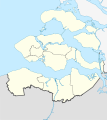
Soubor:Netherlands Zeeland location map.svg

Velikost tohoto PNG náhledu tohoto SVG souboru: 534 × 600 pixelů. Jiná rozlišení: 214 × 240 pixelů | 427 × 480 pixelů | 683 × 768 pixelů | 911 × 1 024 pixelů | 1 823 × 2 048 pixelů | 890 × 1 000 pixelů.
Původní soubor (soubor SVG, nominální rozměr: 890 × 1 000 pixelů, velikost souboru: 262 KB)
Historie souboru
Kliknutím na datum a čas se zobrazí tehdejší verze souboru.
| Datum a čas | Náhled | Rozměry | Uživatel | Komentář | |
|---|---|---|---|---|---|
| současná | 28. 5. 2009, 14:03 |  | 890 × 1 000 (262 KB) | Erik Frohne | == Beschreibung == {{Information |Description={{en|1=Location map of province Zeeland in the Netherlands Equirectangular projection, N/S stretching 160 %. Geographic limits of the map: * N: 51.80° N * S: 51.10° N * W: 3.30° E * E: 4.30° E}} {{de|1 |
Využití souboru
Tento soubor používá následující stránka:
Globální využití souboru
Tento soubor využívají následující wiki:
- Využití na bg.wikipedia.org
- Využití na de.wikipedia.org
- Zierikzee
- Zeelandbrug
- Fernsehturm Goes
- Zuid-Beveland
- Wikipedia:Kartenwerkstatt/Positionskarten/Europa
- Zandenburg
- Vorlage:Positionskarte Niederlande Zeeland
- Krijn
- Dreiband-Weltcup 2009/1
- Leuchtturm Westerlichttoren
- Leuchtturm Westkapelle (Unterfeuer)
- Tholen (Insel)
- Leuchtturm Nieuwe Sluis
- Dreiband-Weltcup 2005/1
- Dreiband-Weltcup 2006/1
- Dreiband-Weltcup 2007/1
- Dreiband-Weltcup 2008/1
- Brug Sas van Gent
- Sluiskilbrug
- Manteling van Walcheren
- Drehbrücke Souburg
- Využití na de.wikivoyage.org
- Využití na eo.wikipedia.org
- Využití na es.wikipedia.org
- Využití na frr.wikipedia.org
- Využití na fr.wikipedia.org
Zobrazit další globální využití tohoto souboru.

