Soubor:MGRSgridHawaiiSchemeAA.png

Velikost tohoto náhledu: 800 × 512 pixelů. Jiná rozlišení: 320 × 205 pixelů | 640 × 409 pixelů | 991 × 634 pixelů.
Původní soubor (991 × 634 pixelů, velikost souboru: 123 KB, MIME typ: image/png)
Historie souboru
Kliknutím na datum a čas se zobrazí tehdejší verze souboru.
| Datum a čas | Náhled | Rozměry | Uživatel | Komentář | |
|---|---|---|---|---|---|
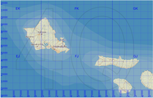
| současná | 21. 11. 2007, 12:32 |  | 991 × 634 (123 KB) | MikaelR | {{Information |Description={{en|Map of the Military Grid Reference System (MGRS) around Hawaii, with the AA lettering scheme for the 100 km squares. This scheme is used for WGS 84 and some other modern geodetic datums, while the alternative AL lettering s |
Využití souboru
Tento soubor používá následující stránka:
