Soubor:Kagoshima in Kagoshima Prefecture.png

Velikost tohoto náhledu: 800 × 534 pixelů. Jiná rozlišení: 320 × 213 pixelů | 640 × 427 pixelů | 1 024 × 683 pixelů | 1 201 × 801 pixelů.
Původní soubor (1 201 × 801 pixelů, velikost souboru: 34 KB, MIME typ: image/png)
| Tento soubor pochází z Wikimedia Commons. Níže jsou zobrazeny informace, které obsahuje jeho tamější stránka s popisem souboru. |
Popis
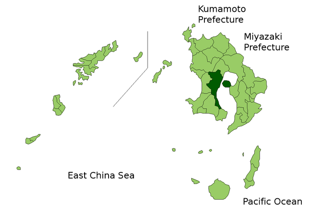
| Popis | Location Map of Kagoshima in Kagoshima Prefecture, Japan |
| Datum | |
| Zdroj | Image:KagoshimaMapCurrent.png and rework |
| Autor | user:alberth2 |
| Svolení (Užití tohoto souboru) |
PD |
Licence
| Já, autor tohoto díla, jej tímto uvolňuji jako volné dílo, a to celosvětově. V některých zemích to není podle zákona možné; v takovém případě: Poskytuji komukoli právo užívat toto dílo za libovolným účelem, a to bezpodmínečně s výjimkou podmínek vyžadovaných zákonem. |
Historie souboru
Kliknutím na datum a čas se zobrazí tehdejší verze souboru.
| Datum a čas | Náhled | Rozměry | Uživatel | Komentář | |
|---|---|---|---|---|---|
| současná | 23. 3. 2010, 08:39 | | 1 201 × 801 (34 KB) | Alberth2 | Kajiki Town, Kamō Town and Aira Tow were merged to Aira City. |
| 1. 11. 2008, 05:03 |  | 1 201 × 801 (34 KB) | Alberth2 | Ōkuchi and Hishikari merged to Isa. | |
| 1. 12. 2007, 08:21 |  | 1 201 × 801 (34 KB) | Alberth2 | Kawanabe, Chiran, and Ei are merged into Minamikyūshū City. | |
| 5. 10. 2007, 03:17 |  | 1 201 × 801 (34 KB) | Alberth2 | == Summary == {{Information |Description=Location Map of Kagoshima in Kagoshima Prefecture, Japan |Source=Image:KagoshimaMapCurrent.png and rework |Date=Oct. 5th, 2007 |Author=user:alberth2 |Permission=PD |other_versions= }} == Licensing == {{PD |
Využití souboru
Tento soubor používá následující stránka:
Globální využití souboru
Tento soubor využívají následující wiki:
- Využití na ar.wikipedia.org
- Využití na arz.wikipedia.org
- Využití na ca.wikipedia.org
- Využití na ce.wikipedia.org
- Využití na el.wikipedia.org
- Využití na et.wikipedia.org
- Využití na eu.wikipedia.org
- Využití na fo.wikipedia.org
- Využití na fr.wikipedia.org
- Využití na ga.wikipedia.org
- Využití na gl.wikipedia.org
- Využití na hr.wikipedia.org
- Využití na hu.wikipedia.org
- Využití na it.wikipedia.org
- Využití na mzn.wikipedia.org
- Využití na no.wikipedia.org
- Využití na ro.wikipedia.org
- Využití na tg.wikipedia.org
- Využití na tt.wikipedia.org
- Využití na war.wikipedia.org
- Využití na www.wikidata.org
- Využití na zh-classical.wikipedia.org
- Využití na zh-min-nan.wikipedia.org
- Využití na zh.wikipedia.org