Soubor:Ireland location map.svg

Velikost tohoto PNG náhledu tohoto SVG souboru: 481 × 599 pixelů. Jiná rozlišení: 192 × 240 pixelů | 385 × 480 pixelů | 616 × 768 pixelů | 822 × 1 024 pixelů | 1 643 × 2 048 pixelů | 1 450 × 1 807 pixelů.
Původní soubor (soubor SVG, nominální rozměr: 1 450 × 1 807 pixelů, velikost souboru: 938 KB)
| Tento soubor pochází z Wikimedia Commons. Níže jsou zobrazeny informace, které obsahuje jeho tamější stránka s popisem souboru. |
Popis
| Popis |
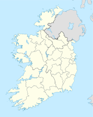
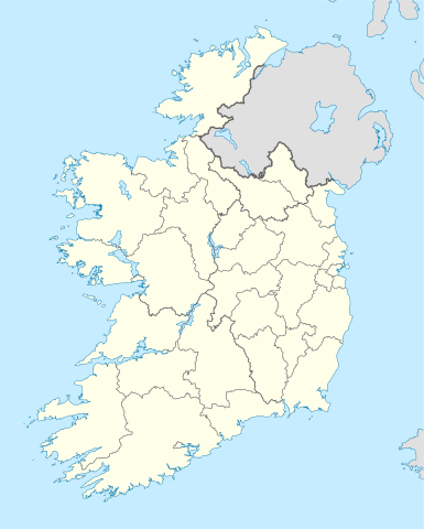
Deutsch: Positionskarte von Irland
Quadratische Plattkarte, N-S-Streckung 170 %. Geographische Begrenzung der Karte:
English: Location map of Ireland
Equirectangular projection, N/S stretching 170 %. Geographic limits of the map:
|
| Datum | 01-07-2008 |
| Zdroj | own work, using United States National Imagery and Mapping Agency data |
| Autor | NordNordWest |
| Další verze |
DerivativeVersions |


|
Tato mapa byla vytvořena nebo vylepšena v německé Kartenwerkstatt (Mapová laboratoř). Můžete také navrhnout mapy k vylepšení.
|
Licence
Já, držitel autorských práv k tomuto dílu, ho tímto zveřejňuji za podmínek následujících licencí:

|
Tento dokument smí být kopírován, šířen nebo upravován podle podmínek Svobodné licence GNU pro dokumenty verze 1.2 nebo libovolné vyšší verze publikované nadací Free Software Foundation. Dokument nemá neměnné části ani texty na předním či zadním přebalu. Kopie textu licence je k dispozici v oddíle nazvaném GNU Free Documentation License. |
Tento soubor podléhá licenci Creative Commons Uveďte autora-Zachovejte licenci 3.0 Unported
- Dílo smíte:
- šířit – kopírovat, distribuovat a sdělovat veřejnosti
- upravovat – pozměňovat, doplňovat, využívat celé nebo částečně v jiných dílech
- Za těchto podmínek:
- uveďte autora – Máte povinnost uvést autorství, poskytnout odkaz na licenci a uvést, pokud jste provedli změny. Toho můžete docílit jakýmkoli rozumným způsobem, avšak ne způsobem naznačujícím, že by poskytovatel licence schvaloval nebo podporoval vás nebo vaše užití díla.
- zachovejte licenci – Pokud tento materiál jakkoliv upravíte, přepracujete nebo použijete ve svém díle, musíte své příspěvky šířit pod stejnou nebo slučitelnou licencí jako originál.
Můžete si zvolit libovolnou z těchto licencí.
Historie souboru
Kliknutím na datum a čas se zobrazí tehdejší verze souboru.
| Datum a čas | Náhled | Rozměry | Uživatel | Komentář | |
|---|---|---|---|---|---|
| současná | 18. 7. 2020, 08:45 | | 1 450 × 1 807 (938 KB) | Chipmunkdavis | Adding toggle to display pre-2014 boundaries, adjusting some code for names and shape |
| 11. 7. 2020, 08:47 |  | 1 450 × 1 807 (908 KB) | Chipmunkdavis | Overhauling code, together with code from File:Galway City in Ireland.svg (itself derived from this file), to be both simpler and more easily editable. All islands are now grouped with their mainland county, and counties are grouped into provinces. Groups exist for traditional counties where divided. | |
| 12. 9. 2014, 14:08 |  | 1 450 × 1 807 (597 KB) | Ravenpuff | Retry that | |
| 12. 9. 2014, 13:57 |  | 1 450 × 1 807 (597 KB) | Ravenpuff | Merged North Tipperary and South Tiperrary, Limerick and County Limerick, Waterford and County Waterford (Local Government Reform Act 2014) | |
| 1. 9. 2009, 20:04 |  | 1 450 × 1 807 (598 KB) | NordNordWest | ||
| 25. 8. 2008, 21:08 |  | 1 450 × 1 807 (599 KB) | NordNordWest | size correction | |
| 19. 7. 2008, 20:13 |  | 483 × 602 (581 KB) | NordNordWest | ||
| 1. 7. 2008, 16:13 |  | 483 × 602 (554 KB) | NordNordWest | {{Information |Description= {{de|Positionskarte von Irland}} Quadratische Plattkarte, N-S-Streckung 170 %. Geographische Begrenzung der Karte: * N: 55.6° N * S: 51.2° N * W: 11.0° W * O: 5.0° W {{en|Location map of [[:en:Ireland|Ireland |
Využití souboru
Tento soubor používá následujících 70 stránek:
- A Division 1922/1923
- Abbeyfeale
- Abbeyleix
- Acaill
- Adare
- Aghamore
- Ahascragh
- Arklow
- Ashbourne (Irsko)
- Athlone
- Ballinaglera
- Bray
- Carlingford (Louth)
- Carlow
- Carrick-on-Shannon
- Carrickfergus
- Castlebar
- Cootehill
- Cork
- Doolin
- Drogheda
- Drumsna
- Dublin
- Dublinská mešita
- Dundalk
- Dungarvan
- Dún Laoghaire
- Enfield (hrabství Meath)
- Ennis
- Ennistimon
- Galway
- Greystones
- Julianstown
- Kanturk
- Kells (hrabství Meath)
- Kildare
- Kilkenny
- Killarney
- Kinsale
- Laytown-Bettystown-Mornington
- Limerick
- Lough Allen
- Lough Conn
- Lough Corrib
- Lough Derg (Munster)
- Lough Mask
- Lough Owel
- Lough Ree
- Louisburgh (Irsko)
- Mullingar
- Naas
- Navan
- Oldcastle (hrabství Meath)
- Port Laoise
- Ratoath
- Saltee Islands
- Shannon (město)
- Sixmilebridge
- Sligo (Irsko)
- Swords
- Thurles
- Tralee
- Tuam
- Tullamore
- Waterford
- Westport (Irsko)
- Wexford
- Wicklow
- Wikipedie:WikiProjekt Česko-slovenská Wikipedie/Přeložené články/2015-09/Galerie
- Šablona:LocMap Irsko
Globální využití souboru
Tento soubor využívají následující wiki:
- Využití na af.wikipedia.org
- Využití na am.wikipedia.org
- Využití na ar.wikipedia.org
- Využití na arz.wikipedia.org
- Využití na ba.wikipedia.org
- Využití na be-tarask.wikipedia.org
- Využití na be.wikipedia.org
- Využití na bg.wikipedia.org
Zobrazit další globální využití tohoto souboru.