Soubor:Internet Censorship World Map suggested.svg

Velikost tohoto PNG náhledu tohoto SVG souboru: 800 × 411 pixelů. Jiná rozlišení: 320 × 164 pixelů | 640 × 329 pixelů | 1 024 × 526 pixelů | 1 280 × 657 pixelů | 2 560 × 1 314 pixelů | 863 × 443 pixelů.
Původní soubor (soubor SVG, nominální rozměr: 863 × 443 pixelů, velikost souboru: 1,54 MB)
| Tento soubor pochází z Wikimedia Commons. Níže jsou zobrazeny informace, které obsahuje jeho tamější stránka s popisem souboru. |
Popis
| Popis |
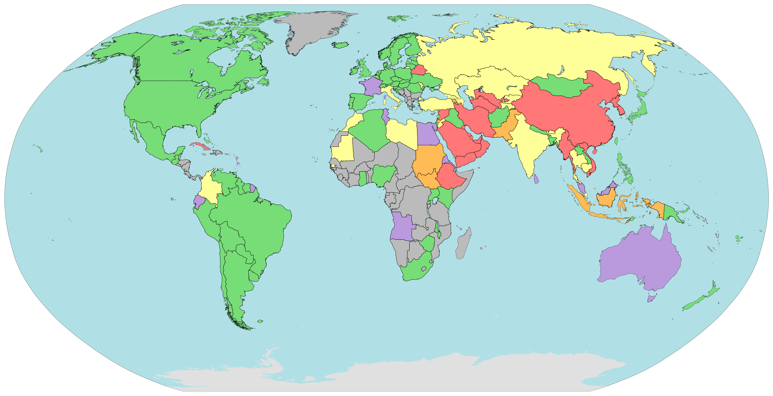
English: A map showing the level of Internet censorship by country throughout the world. Based on Wikipedia:Internet censorship by country and Wikipedia:Censorship by country. |
| Datum | |
| Zdroj | File:Internet_Censorship_World_Map.svg |
| Autor | Jeffrey Ogden (W163) |
Licence
| Tento soubor byl uvolněn pomocí Creative Commons CC0 1.0 Universal Public Domain Dedication. | |
| Osoba, která toto dílo označila tímto dokumentem, dílo uvolnila do public domain tím, že se celosvětově vzdala všech autorských práv ke svému dílu včetně všech souvisejících a příbuzných zákonných práv, které k dílu má, v rozsahu umožněném zákonem. Můžete toto dílo rozmnožovat, upravovat, rozšiřovat či provozovat, i pro komerční účely, vše bez nutnosti žádat o svolení.
|
Historie souboru
Kliknutím na datum a čas se zobrazí tehdejší verze souboru.
| Datum a čas | Náhled | Rozměry | Uživatel | Komentář | |
|---|---|---|---|---|---|
| současná | 11. 1. 2014, 18:36 | | 863 × 443 (1,54 MB) | Joeytje50 | Changed to pastel colours. |
| 11. 1. 2014, 04:04 |  | 863 × 443 (1,54 MB) | Joeytje50 | Fixed fill colour code #0; to #000; which is a typo I must have made after saving and previewing the first time. | |
| 11. 1. 2014, 03:59 |  | 863 × 443 (1,54 MB) | Joeytje50 | Thickened borders of dataless countries to 1px and borderless islands to 0.5px, so it looks better. Also made them black, like any other border. Included details about the changes I made in the comments inside the file. | |
| 11. 1. 2014, 03:44 |  | 863 × 443 (1,54 MB) | Joeytje50 | Made the unknown countries darker grey. Indicates an unknown state better. | |
| 11. 1. 2014, 03:30 |  | 863 × 443 (1,54 MB) | Joeytje50 | User created page with UploadWizard |
Využití souboru
Tento soubor používají následující 2 stránky: