Soubor:Denmarkmap - 2.png
Velikost tohoto náhledu: 736 × 600 pixelů. Jiná rozlišení: 295 × 240 pixelů | 589 × 480 pixelů | 995 × 811 pixelů.
Původní soubor (995 × 811 pixelů, velikost souboru: 29 KB, MIME typ: image/png)
| Tento soubor pochází z Wikimedia Commons. Níže jsou zobrazeny informace, které obsahuje jeho tamější stránka s popisem souboru. |

|
This map has been uploaded by Electionworld from en.wikipedia.org to enable the |
Popis
| Popis |
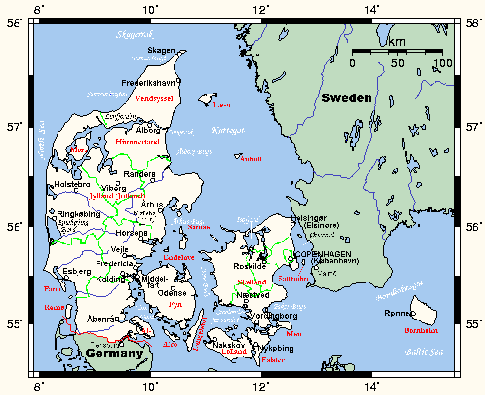
English: Map of Denmark showing main towns, highest point, and other information. This map was created at Online Map Creation and may be considered PD. This map's source is here, with the uploader's modifications, and the GMT homepage says that the tools are released under the GNU General Public License. |
| Datum | |
| Zdroj | Vlastní dílo |
| Autor | Kelisi |
Licence
| |
Uživatel Kelisi z projektu w v jazyce en, autor tohoto díla, jej uvolnil jako volné dílo, a to celosvětově. Není-li to podle zákona možné: |
Původní historie souboru
| Datum a čas | Rozměry | Uživatel | Komentář |
|---|---|---|---|
| 29. prosince 2006, 14:55:48 | 995 × 811 (43965 bytes) | Electionworld (diskuse · příspěvky) | {{ew|en|Kelisi}} Map of Denmark showing main towns, highest point, and other information. This map was created at Online Map Creation and may be considered PD. {{PD}} |
Historie souboru
Kliknutím na datum a čas se zobrazí tehdejší verze souboru.
| Datum a čas | Náhled | Rozměry | Uživatel | Komentář | |
|---|---|---|---|---|---|
| současná | 10. 12. 2014, 21:18 | | 995 × 811 (29 KB) | GifTagger | Bot: Converting file to superior PNG file. (Source: Denmarkmap.gif). This GIF was problematic due to non-greyscale color table. |
Využití souboru
Tento soubor používá následující stránka:
Globální využití souboru
Tento soubor využívají následující wiki:
- Využití na de.wikipedia.org
- Využití na en.wikipedia.org
- Využití na vep.wikipedia.org