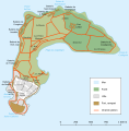
Soubor:Carte Île-d'Aix.svg

Velikost tohoto PNG náhledu tohoto SVG souboru: 591 × 600 pixelů. Jiná rozlišení: 236 × 240 pixelů | 473 × 480 pixelů | 757 × 768 pixelů | 1 009 × 1 024 pixelů | 2 018 × 2 048 pixelů | 736 × 747 pixelů.
Původní soubor (soubor SVG, nominální rozměr: 736 × 747 pixelů, velikost souboru: 72 KB)
Historie souboru
Kliknutím na datum a čas se zobrazí tehdejší verze souboru.
| Datum a čas | Náhled | Rozměry | Uživatel | Komentář | |
|---|---|---|---|---|---|
| současná | 24. 2. 2008, 16:43 |  | 736 × 747 (72 KB) | Mutichou | == Description == {{Information |Description= {{de|Karte von Île d'Aix, Charente-Maritime, Frankreich.}} {{en|Map of Île-d'Aix, Charente-Maritime, France.}} {{eo|Mapo de [[:eo:Île-d'Aix|Île- |
| 24. 2. 2008, 14:07 |  | 736 × 747 (70 KB) | Mutichou | == Description == {{Information |Description= {{de|Karte von Île d'Aix, Charente-Maritime, Frankreich.}} {{en|Map of Île-d'Aix, Charente-Maritime, France.}} {{eo|Mapo de [[:eo:Île-d'Aix|Île- | |
| 24. 2. 2008, 13:57 |  | 736 × 747 (69 KB) | Mutichou | {{Information |Description= {{de|Karte von de:Île d'Aix, Charente-Maritime, Frankreich.}} {{en|Map of en:Île-d'Aix, Charente-Maritime, France.}} {{eo|Mapo de eo:Île-d'Aix, Charente-Maritime, [[France|Francuj |
Využití souboru
Tento soubor používá následující stránka:
Globální využití souboru
Tento soubor využívají následující wiki:
- Využití na eo.wikipedia.org
- Využití na fr.wikipedia.org
- Využití na it.wikipedia.org
- Využití na oc.wikipedia.org
- Využití na ru.wikipedia.org
- Využití na sl.wikipedia.org
- Využití na zh.wikipedia.org