Soubor:AS17-M-0431.jpg
Původní soubor (1 012 × 1 012 pixelů, velikost souboru: 198 KB, MIME typ: image/jpeg)
| Tento soubor pochází z Wikimedia Commons. Níže jsou zobrazeny informace, které obsahuje jeho tamější stránka s popisem souboru. |
Popis
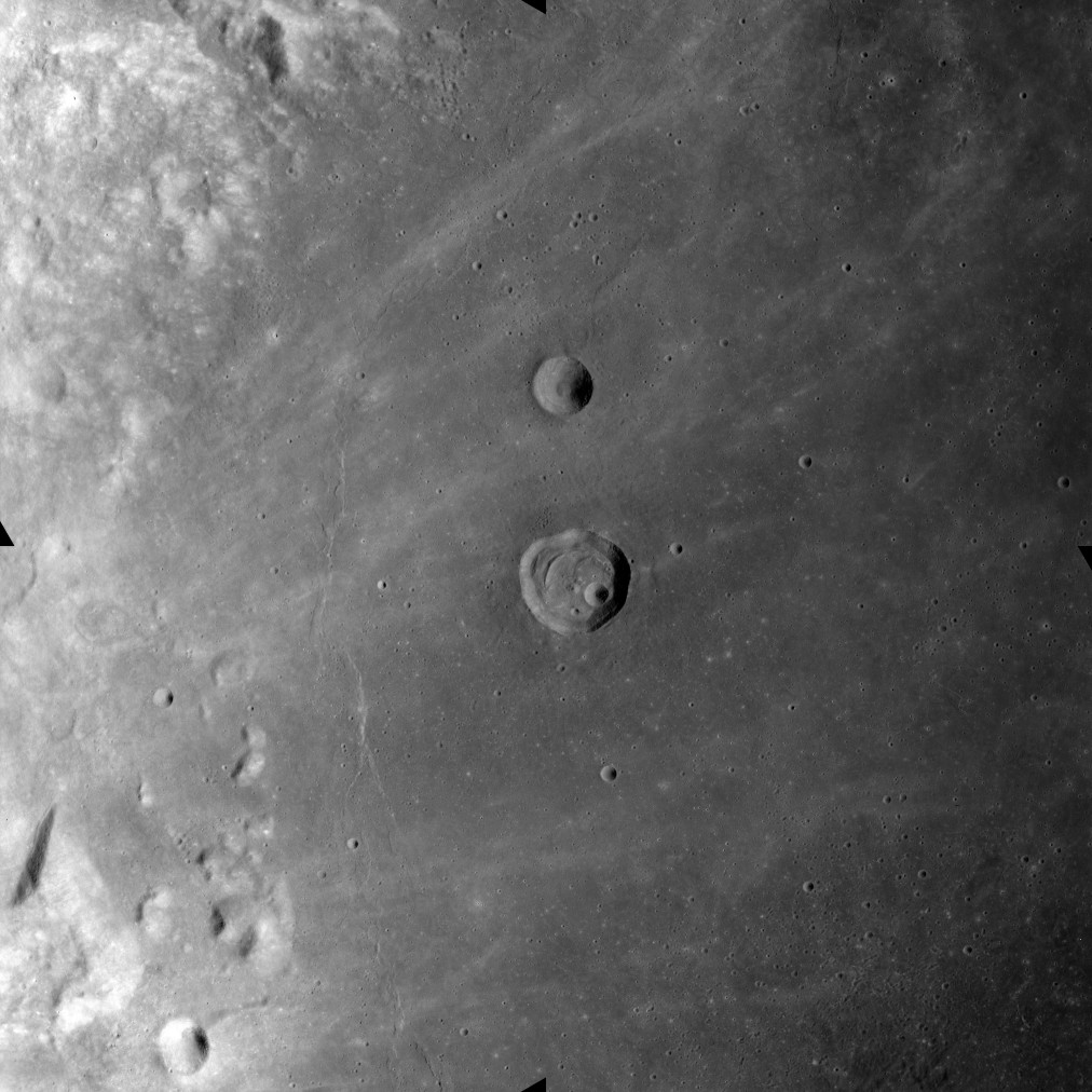
This image was taken during the Apollo 17 mapping metric sequence, revolution #14. The selenographic coordinates of this image are 18.50° N, 53.40° E.
The picture shows the western part of the Mare Crisium, a roughly lunar mare with a diameter of 418 km. The crater at the center of the image is named Peirce, while the smaller crater to the north is Swift. To the west of Perice, and concentric with the edge of the mare, is a wrinkle-ridge named Dorsum Oppel. Wisps of higher albedo material from a ray system can be seen scattered across the otherwise relatively dark surface of the mare.
This picture was produced by reducing a Hi-res image to 25% of full size, then rotating 90° counter-clockwise so that north is toward the top edge.
Source: Lunar & Planetary Institute, http://www.lpi.usra.edu/resources/apollo/frame/?AS17-M-0431 [1]
Licence
| This file is in the public domain in the United States because it was solely created by NASA. NASA copyright policy states that "NASA material is not protected by copyright unless noted". (See Template:PD-USGov, NASA copyright policy page or JPL Image Use Policy.) | ||
 |
Warnings:
|
Historie souboru
Kliknutím na datum a čas se zobrazí tehdejší verze souboru.
| Datum a čas | Náhled | Rozměry | Uživatel | Komentář | |
|---|---|---|---|---|---|
| současná | 26. 10. 2018, 12:52 | | 1 012 × 1 012 (198 KB) | Jstuby | higher resolution, from ASU |
| 26. 1. 2006, 21:44 |  | 603 × 600 (43 KB) | RJHall | Western Mare Crisium from Apollo 17. |
Využití souboru
Tento soubor používá následující stránka:
Globální využití souboru
Tento soubor využívají následující wiki:
- Využití na ba.wikipedia.org
- Využití na bg.wikipedia.org
- Využití na ca.wikipedia.org
- Využití na en.wikipedia.org
- Využití na es.wikipedia.org
- Využití na fa.wikipedia.org
- Využití na ru.wikipedia.org
- Využití na zh.wikipedia.org