Soubor:Çankırı districts.png

Velikost tohoto náhledu: 776 × 600 pixelů. Jiná rozlišení: 311 × 240 pixelů | 621 × 480 pixelů | 994 × 768 pixelů | 1 056 × 816 pixelů.
Původní soubor (1 056 × 816 pixelů, velikost souboru: 37 KB, MIME typ: image/png)
| Tento soubor pochází z Wikimedia Commons. Níže jsou zobrazeny informace, které obsahuje jeho tamější stránka s popisem souboru. |
Popis
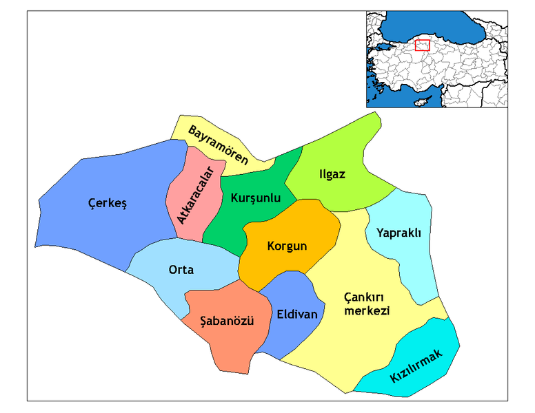
| Popis | Map of the districts of Çankırı province in Turkey. Created by Rarelibra 19:28, 1 December 2006 (UTC) for public domain use, using MapInfo Professional v8.5 and various mapping resources. Edited by One Homo Sapiens Corrected text where İ,Ş,ı,ğ,or ş occurs in name. Source: [statoids-com]. Increased font size and enhanced color differences among adjacent districts. |
| Datum | 31. března 2007 (datum prvotního načtení souboru) |
| Zdroj | No machine-readable source provided. Own work assumed (based on copyright claims). |
| Autor | No machine-readable author provided. Denizz~commonswiki assumed (based on copyright claims). |
Licence
| Já, autor tohoto díla, jej tímto uvolňuji jako volné dílo, a to celosvětově. V některých zemích to není podle zákona možné; v takovém případě: Poskytuji komukoli právo užívat toto dílo za libovolným účelem, a to bezpodmínečně s výjimkou podmínek vyžadovaných zákonem. |
Historie souboru
Kliknutím na datum a čas se zobrazí tehdejší verze souboru.
| Datum a čas | Náhled | Rozměry | Uživatel | Komentář | |
|---|---|---|---|---|---|
| současná | 28. 12. 2008, 23:46 | | 1 056 × 816 (37 KB) | One Homo Sapiens | Corrected text where İ,Ş,ı,ğ,or ş occurs in name. Source: [statoids-com]. Increased font size and enhanced color differences among adjacent districts. |
| 31. 3. 2007, 09:14 |  | 1 056 × 816 (30 KB) | Denizz~commonswiki | == Summary == Map of the districts of Cankiri province in Turkey. Created by Rarelibra 19:28, 1 December 2006 (UTC) for public domain use, using MapInfo Professional v8.5 and various mapping resources. == Licensing == {{PD-self}} <!-- |
Využití souboru
Tento soubor používá následující stránka:
Globální využití souboru
Tento soubor využívají následující wiki:
- Využití na ar.wikipedia.org
- Využití na ast.wikipedia.org
- Využití na ba.wikipedia.org
- Využití na ca.wikipedia.org
- Využití na de.wikipedia.org
- Využití na diq.wikipedia.org
- Využití na en.wikipedia.org
- Çankırı Province
- Wikipedia:Reference desk/Archives/Science/2009 December 25
- Districts of Turkey
- Governor of Çankırı
- List of populated places in Çankırı Province
- Orta District
- Atkaracalar District
- Bayramören District
- Çankırı District
- Çerkeş District
- Eldivan District
- Ilgaz District
- Kızılırmak District
- Korgun District
- Kurşunlu District
- Şabanözü District
- Yapraklı District
- Využití na eo.wikipedia.org
- Využití na es.wikipedia.org
- Využití na eu.wikipedia.org
- Využití na fa.wikipedia.org
Zobrazit další globální využití tohoto souboru.